Top GPS Navigation Tools for Hikers
- Originally Published
- Last Updated:
Even the most seasoned hikers know how quickly things can get confusing. On one trip in the Sandias, we thought we were on the main trail — until it split into three faint tracks. Fortunately, we had preloaded GPS maps and a backup unit, which turned what could have been a stressful scramble into a calm, steady hike back to camp. Experiences like that remind us that GPS navigation isn’t just about gadgets — it’s about peace of mind.
In this guide, we’ll cover the top GPS navigation tools for hikers in 2025. From rugged handheld units and lightweight satellite communicators to versatile smartphone apps, we’ll walk through the strengths and weaknesses of each option. You’ll also learn which features matter most, how to use GPS effectively on the trail, and which tools are the best fit for different hiking styles. We also have a great guide on GPS dog collars to keep your best buddy from getting lost as well.
Why GPS Matters on the Trail
When you’re outdoors, navigation is more than just finding your way from point A to point B — it’s a safety lifeline. A reliable GPS can:
- Keep you on course when trails split or fade.
- Mark important spots like campsites, water sources, or trailheads.
- Provide emergency SOS communication in areas with no cell service.
- Help you retrace your steps if you need to backtrack.
But no GPS tool is flawless. Batteries can drain, signals can drop, and devices can fail at the worst moments. That’s why experienced hikers always carry more than one navigation option and keep a paper map and compass as a backup. Navigation is also part of the 10 Essentials, a checklist every hiker should know and pack — making GPS tools a critical piece of your overall safety kit.
Types of GPS Navigation Tools
Not all GPS solutions work the same way. Some rugged devices power through weeks off-grid, others run as apps on your phone, and a few combine navigation with life-saving SOS messaging. The categories below show how each option differs and when it makes the most sense on the trail.
- Handheld GPS Units: These devices thrive in rugged conditions. They deliver accurate navigation, withstand poor weather, and hold up to rough handling. Backpackers and serious hikers rely on them for long trips when they need dependable performance.
- GPS Watches: These wrist-worn tools track pace, distance, and routes right from your arm. Garmin Fenix and Coros models make it easy to glance at navigation without digging in your pack. Smaller screens limit detail, but they shine on day hikes or as a reliable backup.
- Smartphone GPS Apps: - Apps like Gaia GPS, CalTopo, or AllTrails turn your phone into a full-featured navigation tool. When you download maps offline, you can explore without service. They’re simple to use, but they drain batteries fast — so pack a power bank (see our top pick below).
- Hybrid Satellite Communicators - Devices like the Garmin inReach series blend GPS navigation with two-way messaging and SOS alerts. They keep you connected when cell service disappears, making them a smart choice for solo hikers or remote expeditions.
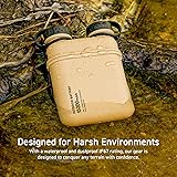
ELECOM NESTOUT Rugged Power Bank 15000mAh Outdoor Charger, 32W USB C Fast Charging PD, Waterproof IP67, Heavy Duty Shockproof, Tactical Battery Pack for iPhone Tablet Hiking Camping Survival
Look For The Features That Matter
Choosing the right GPS tool means looking beyond the brand name. Not every advertised feature matters in real-world hiking. Extras like built-in cameras, geocaching games, or advanced fitness tracking can feel nice-to-have, but they don’t improve your navigation or safety. Prioritize the essentials first — the bells and whistles come second. Focus on the features that affect your safety and experience on the trail:
- Battery life: Multi-day trips need long-lasting power or replaceable batteries.
- Offline maps: Crucial when there’s no cell signal.
- Ruggedness: — Waterproofing, shock resistance, and durability.
- Satellite networks: — Multi-band GPS, GLONASS, or Galileo improve accuracy.
- Ease of use: — Big buttons or touchscreens that work in gloves.
- Waypoints and routes: The ability to pre-load, mark, and save locations.
- Connectivity: Syncing with apps or transferring GPX files.
- Emergency features: SOS, messaging, or satellite communicator functions.
Top Handheld GPS Units for Hikers
If you want durability and reliability off-grid, handheld GPS units remain the gold standard. These devices are built to survive tough conditions, deliver accurate navigation, and keep working when your phone battery gives up. Here are some of the best options available right now:
- Garmin GPSMAP 67i ($$$$): Garmin’s flagship handheld with up to 165 hours of battery life in tracking mode (about a week of use), multi-band satellite support, and SOS messaging via inReach. Weight: 230 g. It shines on long expeditions where reliability matters most.
- Garmin eTrex 32x ($$): A budget-friendly option with up to 25 hours of battery life and expandable maps via microSD. Weight: 141 g. It delivers simple, reliable performance, making it a solid pick for casual hikers who want a dedicated GPS without the high price tag.
- TwoNav Aventura 2 ($$$): Built in Europe, this rugged device features a bright 3.7” touchscreen, advanced map support, and up to 36 hours of battery life. Weight: 250 g. It’s a great alternative for hikers who want something outside the Garmin ecosystem.
- Magellan eXplorist 610 ($$$): A tough handheld with a 3” touchscreen, preloaded topo maps, and support for paperless geocaching. Battery life runs up to 18 hours. Weight: 195 g. It offers strong durability and versatile mapping features for hikers who want an alternative to the mainstream options.
Top GPS Watches for Hikers
GPS watches put navigation on your wrist and double as fitness companions. They don’t match the detail of a handheld unit, but their convenience makes them a great option for many hikers. Here are some of the top rated choices:
- Garmin Fenix 7 ($$$$): A feature-packed multisport watch with topo maps, strong durability, and up to 57 hours in GPS mode. Weight: 79 g. Perfect for hikers who also want advanced training metrics.
- Coros Vertix 2 ($$$$): Known for exceptional battery life — up to 140 hours in GPS mode — and a rugged build. Weight: 89 g. It supports multiple satellite systems and works well for long-distance adventures.
- Suunto 9 Peak Pro ($$$): Slim and lightweight at just 64 g, with up to 40 hours of GPS use. Its durability and design make it a strong choice for minimalist hikers.
- Polar Grit X Pro ($$): Offers turn-by-turn guidance, weather insights, and up to 40 hours in GPS mode. Weight: 79 g. A solid option for those who want navigation plus outdoor training features.
Top Smartphone GPS Apps for Hikers
Your phone isn’t just for playing games and listening to podcasts, it can serve as a powerful GPS tool with the right apps. In fact, most of the time when we are hiking on established trails, this is the way we go. It’s affordable and convenient. Remember, always download maps offline and carry a backup power source. (p.s. Here are our favorite outdoor podcasts).
- AllTrails ($): Perfect for discovering new trails with community reviews and easy-to-follow routes. Best for day hikes and casual users. We use this app and website all the time.
- Gaia GPS ($$): Offers a huge map library, offline downloads, and easy trip planning. Ideal for both casual hikes and detailed backcountry routes.
- CalTopo ($$): A favorite among serious planners. It provides detailed topo maps, overlays, and powerful route planning tools.
- OsmAnd (Free/$): Open-source and strong for offline navigation worldwide. The base app is free, with optional paid features. A smart pick for international hikers or those who prefer customizable options.
- Avenza Maps (Free/$): Popular for its downloadable map store, including official park and forest service maps. The free version allows a limited number of maps, with paid upgrades available. Great for safety-focused hikers who want accurate, official map layers.
- Mapy.cz (Free): A free app with excellent offline topo maps, especially strong in Europe but with growing worldwide coverage. A budget-friendly option for hikers who want reliable offline navigation without subscriptions.
Top Hybrid Satellite Communicators
These devices combine GPS navigation with two-way messaging and SOS alerts, making them essential for remote adventures. Subscription plans are usually required, so factor that into your budget.
- Garmin inReach Mini 2 ($$$): Compact and lightweight with SOS capability and two-way messaging. Battery life lasts up to 14 days in default mode. Weight: 100 g. Ideal for ultralight backpackers and thru-hikers.
- Garmin GPSMAP 66i ($$$$): Combines handheld GPS navigation with inReach messaging. Battery life up to 35 hours in 10-minute tracking mode. Weight: 230 g. Great for those who want an all-in-one solution.
- Zoleo Satellite Communicator ($$): Pairs with your phone for SOS and two-way messaging. Battery life lasts about 200+ hours. Weight: 150 g. An affordable non-Garmin option that covers most remote areas reliably.
- Spot X ($$): Offers two-way messaging, SOS functions, and built-in keyboard. Battery life runs up to 240 hours in tracking mode. Weight: 200 g. A practical alternative for hikers who want satellite communication outside of the Garmin lineup.
Best Picks by Type of Hiker
With so many options available, the right GPS tool often depends on the type of hiking you do. Here are some quick recommendations tailored to different hikers:
- Day Hiker: Use a smartphone app like AllTrails or Mapy.cz paired with a power bank. Lightweight and affordable, this setup keeps you covered for short, local adventures.
- Weekend Backpacker: Carry a mid-range handheld like the Garmin eTrex 32x or TwoNav Aventura 2. Combine it with Gaia GPS for route planning and redundancy.
- Thru-Hiker: Prioritize weight and battery efficiency. The Garmin inReach Mini 2 plus a Coros Vertix 2 watch makes a powerful yet compact duo.
- Remote Expedition: Rely on a robust handheld such as the Garmin GPSMAP 67i or Magellan eXplorist 610, paired with a satellite communicator like Zoleo for messaging.
- Family Hiker: Keep it simple with AllTrails for trail discovery and navigation, backed up by a paper map. A GPS watch can help keep track of mileage with kids in tow.
- Solo Adventurer: Safety takes priority — choose a hybrid communicator like the Garmin 66i or Spot X to combine navigation and SOS functions in one.
How to Use GPS Tools Effectively
Having the right device or app is only half the battle. Using it well makes the real difference on the trail. Here are some tips to get the most from your GPS tools:
- Plan before you go — Download offline maps, set waypoints, and double-check your planned route. Test your device and make sure you know how to access critical functions like marking a waypoint or sending an SOS.
- Manage battery life — Use power-saving modes, dim the screen, and carry spare batteries or a power bank. Keep your GPS warm in cold weather to protect battery performance. Long trips require strict energy management.
- Track smart — Record your route when it helps, but pause tracking to conserve power if you don’t need a full breadcrumb trail. Consider logging waypoints at key junctions, campsites, or water sources instead of continuous tracking.
- Cross-check navigation — Use your GPS alongside paper maps and a compass. Regularly compare your digital position with your map to build confidence in both tools. Never rely on a single navigation method.
- Stay oriented in real time — Don’t wait until you’re lost to check your GPS. Glance at your position at trail junctions, before leaving camp, or when terrain looks confusing. Small corrections prevent big mistakes.
- Share and sync data — Export GPX files, save track logs, and sync with apps like Gaia or CalTopo. Reviewing your hike helps with future planning and makes it easier to share safe, accurate routes with others.
- Practice at home — Learn how to use your GPS before heading deep into the backcountry. Practice importing routes, adjusting settings, and using features so you don’t waste time figuring it out in a stressful situation.
Final Thoughts
The best GPS navigation tool depends on how and where you hike. Day hikers may do fine with a free smartphone app and a power bank, while remote explorers benefit from rugged handhelds or satellite communicators. What matters most is choosing a tool you trust, practicing with it before your trip, and pairing it with traditional navigation skills.
Technology makes adventures safer and more enjoyable, but it’s no replacement for preparation. Always carry backups, know your limits, and treat navigation as part of your safety system — just like food, water, and first aid. With the right GPS setup, you’ll spend less time worrying about where you are and more time enjoying the journey.
What to explore next
Your adventure doesn’t have to end here—explore more guides like this one in our Night hiking hub.
If You Found This Helpful, Please Share:
By Summer and Bill

Summer and Bill are the dynamic duo behind Adventureite.com, a blog dedicated to inspiring others to explore the great outdoors. With a combined lifetime of experience traveling and adventuring across America, they have a wealth of knowledge to share. From hiking to camping, kayaking to travel, Summer and Bill are passionate about helping others discover the beauty of the natural world.